Auteur: Amelia Fernandez
5 mei 2022
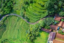
Training on Real Water Savings finished for Bangladesh, China and Indonesia
Last month, FutureWater concluded training programs on Real Water Savings for Bangladesh, China and Indonesia. This training was part of the project ‘Delivering Training on Real Water Savings (ReWaS) for the Regional Water Scarcity Program in Bangladesh, Indonesia, India, Thailand and China’ that FutureWater is rolling out in cooperation with the Regional Office for Asia...
26 april 2022
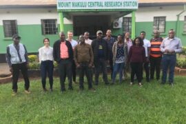
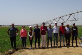
First Module of Tailor-made Training on Geo-spatial Data Skills Successfully Kicked-off in Zambia
Last week, first module of the Nuffic TMT training course on Geo-spatial data skills development was kicked-off at Zambia Agricultural Research Institute (ZARI). Solidaridad is partnering with FutureWater to conduct a tailor-made training on ‘Geo-spatial data skills development for improved soil water management and enhanced crop productivity at the national level in Zambia’. The training...
20 april 2022
Infosequia Is Now Part of the TWIGA Portal, a Platform That Brings Together Multiple Geoclimatic Services in Africa
InfoSequia is the Drought Early Warning and Forecasting System developed by FutureWater to support the decision-making and risk management of drought impacts. InfoSequia rests on an advanced cloud computing and geoprocessing architecture able to effectively integrate large volume of data from satellite, reanalysis and ground-observation networks, with machine learning techniques to generate local-tailored seasonal outlooks...

15 april 2022
Nature-based Solutions (NbS) for Water Security: FutureWater Prepares NbS Options Factsheets for TNC
Recently, The Nature Conservancy (TNC) has published a How-to Guide to Develop Watershed Investment Programs, accessible here. This important resource was designed to meet the needs of practitioners and investors across a variety of sectors who may wish to improve biodiversity, climate and water security outcomes by employing nature-based solutions. It comprises several components, including...
4 maart 2022
InfoSequia: Finalist in the 2nd Dinapsis Innovation Open Challenge
FutureWater recently submitted the InfoSequia solution to the 2nd Dinapsis Challenge, an innovation call launched by Dinapsis, the network of digital hubs of the Agbar group. This second challenge focused on innovative solutions and apps developed to cope with “Extreme weather events, optimization of water consumption, and management of wastewater”. 48 proposals were submitted to...
14 februari 2022
Video: Beneficiaries Share Their Experience on Using Geodata Innovations in Field Schools in Egypt
The project ‘A Practical Farmers Toolkit – Geodata for climate smart agriculture in Egypt’ has successfully finished last month. An exciting video was made, which gives a short overview of this agricultural project. An interactive training programme started in April 2021 with online training, field schools, and group projects. The ‘toolkit’ provided in this project...
22 december 2021
Training to Enhance Agricultural Production in Iraq Completed Succesfully
The Nuffic TMT training on ‘Climate smart irrigation strategies to improve salinity control and enhance agricultural production in Iraq’, provided by FutureWater and Wageningen University, in collaboration with Basra University has been completed successfully. The training, using the FutureWater Moodle School, was aimed at building capacity of participants in accessing and using innovative public-domain data,...

15 december 2021
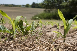
FAO and FutureWater Putting Emphasis on Reuse of Water in Irrigation
Reuse of water in irrigation systems has been ignored to a great extent in developing and rehabilitating irrigation projects. Focus of many projects is on water withdrawals rather than on water consumption. Although this distinction between withdrawals and consumption might seem somewhat academic, it is important in a better understanding of irrigation systems. Moreover, it...
10 maart 2021
Results from Pilot Project on ‘Cadastre Mapping with Flying Sensor Imagery in Mozambique’ Now Published
FutureWater conducted a very interesting and innovative pilot project for TerraFirma (Mozambique) on using flying sensor imagery for cadastre mapping. Flying sensor imagery was obtained through various flights in Quelimane, Mozambique for an area with small-scale agriculture. Field boundaries were determined with the flying sensor imagery using various classification and segmentation algorithms, namely R packages...
