Concept
Momenteel zijn er veel verschillende gewasgroeimodellen beschikbaar, ook wel agrohydrologische modellen genoemd. De modelconcepten, leidende vergelijkingen en onderliggende theorie van deze modellen lopen vaak erg uiteen.
Sommige modellen gebruiken voornamelijk empirische vergelijkingen om de processen te beschrijven, terwijl andere modellen complexere mechanistische vergelijkingen bevatten om een bepaalde gewas- of bodemwaterreactie vast te leggen. De meeste modellen bevatten echter een mix van empirische en mechanistische concepten.
Voor de gewasgroei componenten van de modellen is het belangrijkste onderscheid dat kan worden gemaakt in de onderliggende vergelijkingen, of ze
- straling (of licht) gebruiks efficiëntie gebasseerd,
- fotosynthese gebaseerd, of
- watergebruik efficiëntie gebaseerd zijn.
Afhankelijk van de benodigde analyse, onderzoeksvraag en beschikbaarheid van data moet er een keuze gemaakt worden voor een model.
De concepten achter het modelleren van de dynamiek van het grondwater variëren van het gebruik van een eenvoudig “leaky-bucket” model tot modellen die complexere algoritmen oplossen op basis van de Richards-vergelijkingen. De impact van waterstress op de groei van gewassen wordt vaak beschreven door ofwel (i) een “tipping bucket”-concept via f.e. stressreactiefuncties of kan (ii) Richards ‘potentieel gedreven zijn.
FutureWater gebruikt gewasgroeimodellen in verschillende contexten en toepassingen. Het model van keuze hangt af van elk project en elke vereiste. Veel gebruikte modellen zijn bijvoorbeeld: SWAP (Soil, Water, Atmosphere and Plant), de crop module van de Soil Water Assessment Tool, (SWAT) en FAO´s AquaCrop.
FutureWater-toepassingen
Gewasgroeimodellen en satellieten
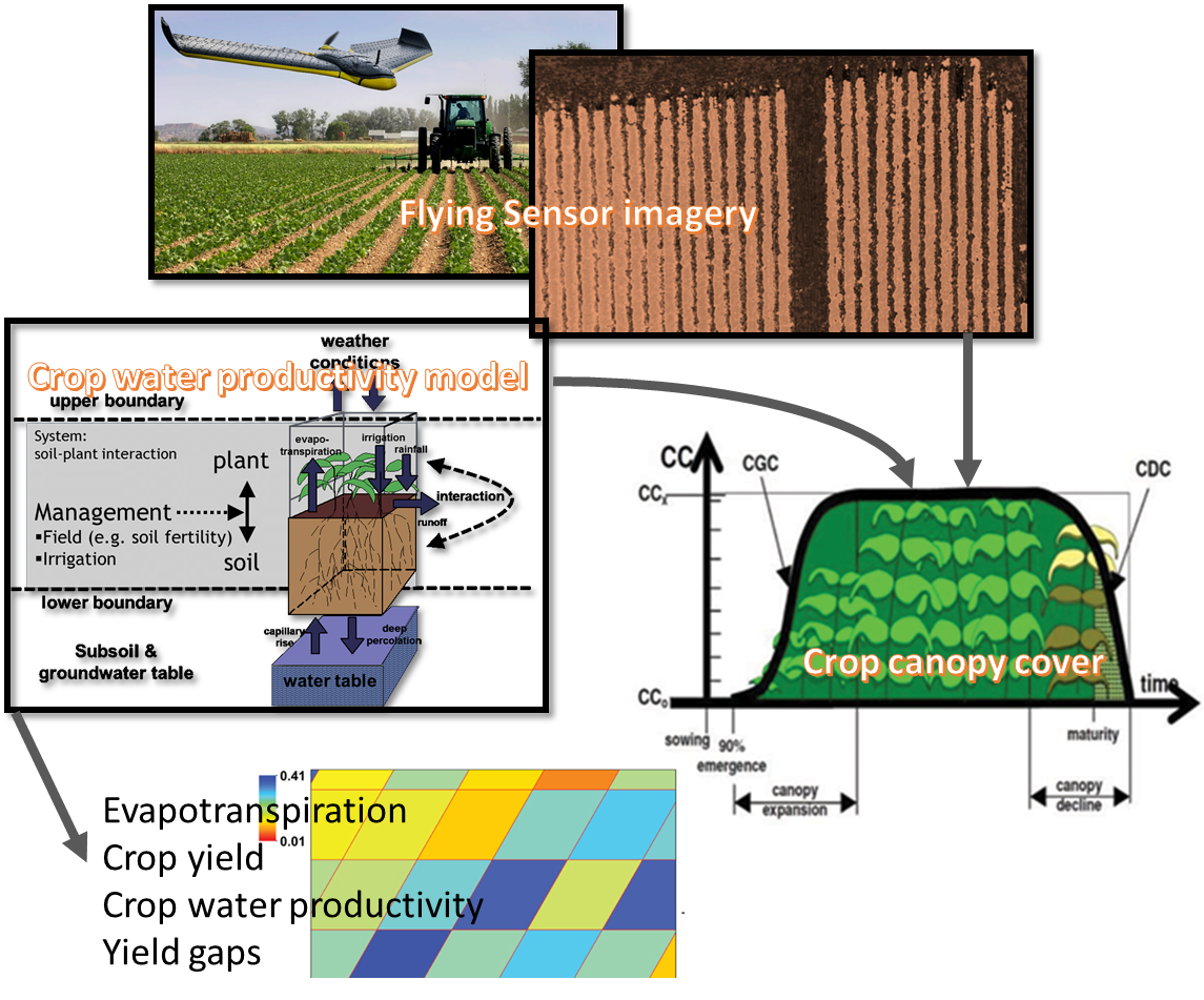
Gewasgroeimodellen bieden voorspellingen over de ontwikkeling en groei van gewassen. Satellietgegevens kunnen worden gebruikt om de gewasontwikkeling te meten door middel van indices als NDVI, Leaf Area Index (LAI) en Canopy Cover.
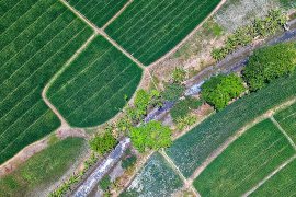
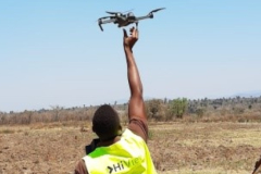
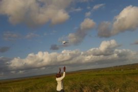
FutureWater gebruikt satellietinformatie over de gewasstatus om de gewasgroeimodellen te verbeteren, wat leidt tot nauwkeurigere en realistischere resultaten. Het voordeel van satellietdata is dat het lange en consistente tijdreeksen kan opleveren. Maar ook data op basis van Flying Sensors (drones) kan nuttige informatie met hoge resolutie over de gewasontwikkeling opleveren.
Canopy Cover kan bijvoorbeeld uit deze beelden worden gehaald en worden gebruikt in combinatie met waterproductiviteitsmodellen om opbrengsten en waterproductiviteit te beoordelen.
Gewasgroeimodellen en gevolgen van klimaatverandering
Gewasgroeimodellen kunnen worden gebruikt om de effecten van klimaatverandering op de voedselzekerheid te beoordelen. Om de effecten van klimaatverandering op de gewasproductie te beoordelen moet een combinatie van factoren worden overwogen, voornamelijk: temperatuurafhankelijke veranderingen, veranderingen in waterbeschikbaarheid en CO2-veranderingen die de assimilatie van biomassa beïnvloeden.
Typisch vereist dit type analyse dat een groot aantal simulaties moet worden uitgevoerd over verschillende dimensies: tijdhorizonnen, regio’s, gewassoorten, grondsoorten, onder andere. FutureWater heeft dit type analyse uitgevoerd voor verschillende agro-klimatologische regio’s in de wereld en voor verschillende schaalniveaus (regionaal tot globaal). FutureWater presenteert de resultaten van dit type analyse op een verteerbare manier aan besluitvormers.
Gerelateerde projecten
-
Strategic Climate Adaptation Planning for the Amu Darya Basin in Uzbekistan
Uzbekistan's water resources depend to a large extent on those provided by the transboundary Amu Darya river which are fully allocated and highly sensitive to climate change and water demand and management changes. Especially the agricultural sector, but also the energy and urban water supply sector need to transform into...
-
SOSIA: Small-Scale Open Source Satellite-based Irrigation Advice
FutureWater currently furthers the development of the SOSIA tool: an irrigation advice for small-scale food producers. Due to the lack of local weather station data, virtual weather stations derived from open-source satellite data are established, and combined with crop stage, and projected and historical precipitation data. The SOSIA tool allows...
-
Tailor-made Training on Geo-spatial Data Skills Development in Zambia
This tailor-made training, funded by Nuffic and requested by the staff of the The Ministry of Agriculture of the Government of the Republic of Zambia (GRZ), aims to help improving soil water management and crop productivity at the national level. The training focuses on building capacity of participants in accessing...
-
BONEX: Boosting Nexus Framework Implementation in the Mediterranean
BONEX is a project funded by the PRIMA-EU Foundation specifically for the Mediterranean Region. This region faces several challenges to ensure future food and water security, whilst preserving ecosystems. BONEX explores and develops specific solutions promoting the linking of governance with practice to overcome barriers to WEFE (water, energy, food,...
-
Training on Real Water Savings for FAO’s Regional Water Scarcity Program
The Regional Office for Asia and the Pacific (RAP) of the Food and Agriculture Organization of the United Nations (FAO) has recently secured funds to continue a program of training on ReWaS, which is a simple tool to estimate the potential for generating real water savings from various agronomic, water...
-
HiFarm: Data Driven Agricultural Intensification Pilot Program for Maize, Coffee and Tea Farmers in Kenya
The eco.business Fund, in partnership with FutureWater and Export Trading Group (ETG), one of the largest integrated agricultural supply chain managers and processors in sub-Saharan Africa, has launched a pilot project in Kenya for data-driven agricultural intensification. This project aims to improve farmer productivity and profitability whilst enhancing the environmental...
-
A Practical Farmers’ Toolkit – Geodata for Climate Smart Agriculture in Egypt
The 'Farmers Toolkit' as presented in this project contains various geodata tools applicable for farmers to assist their decision-making and adopt climate smart agricultural practices. This project launches a training program on these tools, which are: Flying Sensors, irrigation advisory services (IrriWatch portal), WaPOR and Google Earthengine Apps, and Climate...
-
Efficient Irrigation of Oil Palms in Colombia
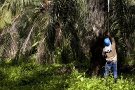
This is a feasibility study on the adoption of more efficient irrigation techniques by oil palm farmers in the Sevilla basin, one of the key basins in the Sierra Nevada, Colombia. The general objective is to identify the local environment at basin scale, the limiting factors and suitable field interventions...
-
Tailor-Made Training on Crop Models and Remote Sensing for Water Management in Agricultural Systems
FutureWater, HiView and ThirdEye Kenya have partnered with Egerton University (Crops, Horticulture & Soils Department) to conduct a tailor-made training on 'Crop models and remote sensing for water management in agricultural systems'. This training project is funded by the NUFFIC - TMT program.
-
Incorporating Flying Sensors to Increase Agricultural Productivity in Central Mozambique
The PROMAC II project is an ongoing project of NCBA Clusa introducing conservation farming practices to various locations in the Manica, Tete and Zambezia provinces, with the objective to increase agricultural productivity. This project incorporates flying sensor activities in the PROMAC II project as a M&E indicator of the practices...
-
Mavo Diami: Services on Land-crop Suitability Mapping and Operational Irrigation Advice in Angola
The overall project goal is to improve sustainable food and income security for >100,000 smallholder farmers in Angola, by accelerating their agri-business performance through informed decisions supported by the Mavo Diami services built on weather, soil and crop signals and other relevant data and indicators. Ensuring the services are offered...
-
Training Package and Technical Guidance for Water Productivity and Real Water Savings
The overall project objective is to compile an inventory of agricultural field interventions and develop a training package to evaluate Real Water Savings from irrigated fields, to systems and basins. A guidance document is developed for agricultural field interventions by compiling a literature database containing published experiences and results of...
-
APSAN-Vale: Piloting Innovations to Increase Water Productivity and Food Security in Mozambique
The project has as its overall aim to increase climate resilient agricultural productivity and food security, with a specific objective to increase the water productivity and profitability of smallholder farmers in Mozambique, prioritizing small (family sector) farmers to increase food and nutritional security. This project will demonstrate what the best...
-
Climate Risk Assessment Using the Decision Tree Framework
The novel methodology that is piloted by the World Bank for assessing climate risks versus other risks on water resource projects, called the Decision Tree Framework (DTF), is applied to two two planned investments: (1) flood protection infrastructure and irrigated cropland expansion on the Nzoia river, Kenya; and (2) the...
-
SMART-WADI: SMART WAter Decisions for Iran
The SMART-WADI project (SMART Water Decisions for Iran), carried out by a consortium of FutureWater, IHE-Delft, and local partner EWERI, focuses on farmers who irrigate their crops with groundwater. The aim is to provide up-to-date information and advice on water productivity, irrigation and farm management. The project combines the latest...
-
Water Productivity mapping using Flying Sensors and Crop Modeling
The objective of this pilot study was to achieve plot-level maps of water productivity and yield to test a methodology to assess the performance of different farmers in order to provide them with recommendations to improve water productivity. More specifically, this pilot study combined high-resolution imagery from Flying Sensors with...
-
ThirdEye: Flying Sensors to Support Farmers’ Decision Making
The ThirdEye project supports farmers in Mozambique and Kenya with their decision making in farm and crop management by setting up a network of flying sensors operators. Our innovation is a major transformation in farmers’ decision making regarding the application of limited resources such as water, seeds, fertilizer and labor....
-
Mainstream Climate Change Adaptation and Mitigation Into Agriculture in the Southern Caucasus
This study contributes to the agriculture sector climate change impact assessment and adaptation and mitigation strategy identification and evaluation. The study encompasses the three countries of the Southern Caucasus region: Armenia, Azerbaijan, and Georgia. The project also includes components for capacity building among in-country staff, and support of the World...
-
Adaptation to Climate Change for Agriculture in The Gambia
Methodology Development of adaptation benefit-cost framework: The framework was developed in a manner to make it possible to isolate development- and climate-related benefits and costs of individual projects and to assess the sensitivity of adaptation benefits and costs to the uncertainty inherent in regional climate change scenarios. Development of analytical tools and procedures: The project...

