Concept
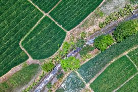
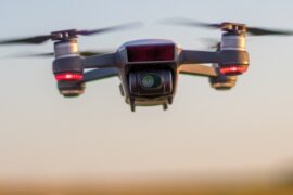
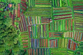
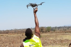
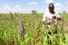
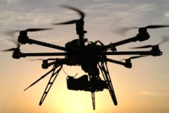
De meeste Sub-Sahara-boeren hebben beperkte middelen tot hun beschikking en vaak geen kennis of toegang tot de juiste gegevens. Passende informatie op de juiste locatie en timing is essentieel voor deze boeren om beslissingen te nemen over de toepassing van hun beperkte middelen zoals water, zaden, kunstmest en arbeid. FutureWater heeft een dienst ontwikkeld met goedkope vliegende sensoren (drones) in een ontwikkelingscontext om ervoor te zorgen dat boeren informatie krijgen op hun specifieke niveau van begrip. Tegelijkertijd is er een netwerk van dienstverleners ontwikkeld die de boeren kunnen ondersteunen bij het maken van de juiste keuzes. De drones bieden waardevolle informatie met een hoge resolutie, waarbij gebruik wordt gemaakt van nabij-infrarood, thermische en visuele beelden om gewasstress op landbouwvelden te detecteren. Nabij-infrarood licht is niet zichtbaar voor het menselijk oog, maar geeft ongeveer 10 dagen eerder informatie over de status van het gewas dan het licht dat zichtbaar is voor menselijk oog. Op basis van de afbeeldingen, die een resolutie hebben van ongeveer 2 cm / pixel, kunnen boeren beslissen waar ze wat gaan doen op het gebied van irrigatie, bemesting en pesticiden.
Met drones kunnen we deze essentiële informatie verstrekken:
- Met een ultrahoge ruimtelijke resolutie
- Met een ongekende flexibiliteit in locatie en timing
- In het spectrum dat niet zichtbaar is voor het menselijk oog
- Met een bedrijfsgerichte aanpak in het land van het project
We zijn ervan overtuigd dat deze innovatie een echte game-changer is, vergelijkbaar met de introductie van mobiele telefoons die boeren directe informatie gaven over markten en marktprijzen. Door de informatie die wordt verzameld met de drones kunnen ze ook hun middelen beheren om de opbrengsten te maximaliseren en tegelijkertijd onnodige verspilling van middelen te verminderen. In plaats van te vertrouwen op gezond verstand, kunnen boeren nu beslissingen nemen op basis van feiten, wat resulteert in een verhoging van de waterproductiviteit. De drones vormen de ontbrekende schakel naar de benodigde agronomische informatie over waar, wat en wanneer te doen, wat leidt tot meer gewas per druppel water!
FutureWater-toepassingen
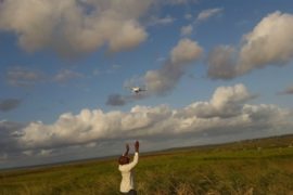
De afgelopen jaren hebben we met succes operationele dronediensten opgezet voor kleine boeren in Kenia en Mozambique. Hier bedienen we op dit moment nog duizenden boeren via een netwerk van lokale operators. Ons bedrijfsmodel gaat uit van het opzetten van onafhankelijke bedrijven in Afrikaanse landen, zoals we tot nu toe deden in Kenia en Mozambique. Deze bedrijven hebben lokale agronomen in dienst die zijn opgeleid in het gebruik van drones. Ze gaan naar de velden van de boeren, voeren vluchten uit, analyseren de beelden en gebruiken deze om advies te geven aan boeren, waar ze direct voor worden betaald.
Op dit moment werken we aan het integreren van thermische camera’s met de drones om specifiek watergerelateerde gewasstress te detecteren en we ontwikkelen online portals waarmee alle kaarten beschikbaar worden gemaakt. Een van deze portalen is hier te vinden.
Gerelateerde projecten
-
Integrated Water Resources Management in Tajikistan
Given the abundant freshwater resources in Tajikistan, water plays a crucial role in the country's socioeconomic development. However, the rising population, economic growth, and the growing impacts of climate change pose significant challenges to ensure water availability and accessibility. This project aims to address the aforementioned information gap by improving...
-
HiFarm: Data Driven Agricultural Intensification Pilot Program for Maize, Coffee and Tea Farmers in Kenya
The eco.business Fund, in partnership with FutureWater and Export Trading Group (ETG), one of the largest integrated agricultural supply chain managers and processors in sub-Saharan Africa, has launched a pilot project in Kenya for data-driven agricultural intensification. This project aims to improve farmer productivity and profitability whilst enhancing the environmental...
-
A Practical Farmers’ Toolkit – Geodata for Climate Smart Agriculture in Egypt
The 'Farmers Toolkit' as presented in this project contains various geodata tools applicable for farmers to assist their decision-making and adopt climate smart agricultural practices. This project launches a training program on these tools, which are: Flying Sensors, irrigation advisory services (IrriWatch portal), WaPOR and Google Earthengine Apps, and Climate...
-
Tailor-made Advice and Training on Flying Sensors for Agriculture in Jordan
This online training was provided over a period of 8 weeks for 25 participants selected by NARC (National Agricultural Research Centre) Jordan. The online training consisted of self-paced exercises and regular live (video) sessions provided through the OpenCourseWare website of IHE Delft. The four modules provided in this training will...
-
Cadastre Mapping with Flying Sensor Imagery in Mozambique
In this project TerraFirma hired FutureWater, HiView and ThirdEye Limitada (Chimoio, Mozambique) to acquire flying sensor imagery over a pilot area near Quelimane, Mozambique. The objective of this pilot project is to determine the suitability of using flying sensor imagery for cadastre mapping in an area of small-scale agriculture in...
-
Tailor-Made Training on Crop Models and Remote Sensing for Water Management in Agricultural Systems
FutureWater, HiView and ThirdEye Kenya have partnered with Egerton University (Crops, Horticulture & Soils Department) to conduct a tailor-made training on 'Crop models and remote sensing for water management in agricultural systems'. This training project is funded by the NUFFIC - TMT program.
-
Determining biomass potential with Lidar point cloud of the Netherlands
This MIT feasibility project investigates the opportunities of an innovation project for determining the biomass potential from local nature management and green maintenance using the publicly available Lidar point cloud of the Netherlands. If the results are positive, this may lead to an innovative logistics support service where producers and...
-
Preventing frost damage in fruit cultivation by thermal imaging with flying sensors
This feasibility project investigates the opportunities of an innovation project for monitoring the effectiveness of wind machines as a frost protection measure in fruit cultivation using flying sensors (drones) equipped with a thermal imager. The results of this feasibility project may lead to an innovative information service to fruit growers...
-
Incorporating Flying Sensors to Increase Agricultural Productivity in Central Mozambique
The PROMAC II project is an ongoing project of NCBA Clusa introducing conservation farming practices to various locations in the Manica, Tete and Zambezia provinces, with the objective to increase agricultural productivity. This project incorporates flying sensor activities in the PROMAC II project as a M&E indicator of the practices...
-
APSAN-Vale: Piloting Innovations to Increase Water Productivity and Food Security in Mozambique
The project has as its overall aim to increase climate resilient agricultural productivity and food security, with a specific objective to increase the water productivity and profitability of smallholder farmers in Mozambique, prioritizing small (family sector) farmers to increase food and nutritional security. This project will demonstrate what the best...
-
SMART-WADI: SMART WAter Decisions for Iran
The SMART-WADI project (SMART Water Decisions for Iran), carried out by a consortium of FutureWater, IHE-Delft, and local partner EWERI, focuses on farmers who irrigate their crops with groundwater. The aim is to provide up-to-date information and advice on water productivity, irrigation and farm management. The project combines the latest...
-
TWIGA: Transforming Weather Water data into value-added Information services for sustainable Growth in Africa
TWIGA aims to provide actionable geo-information on weather, water, and climate in Africa through innovative combinations of new in situ sensors and satellite-based geo-data. With the foreseen new services, TWIGA expects to reach twelve million people within the four years of the project, based on sustainable business models. The TWIGA...
-
Water Productivity mapping using Flying Sensors and Crop Modeling
The objective of this pilot study was to achieve plot-level maps of water productivity and yield to test a methodology to assess the performance of different farmers in order to provide them with recommendations to improve water productivity. More specifically, this pilot study combined high-resolution imagery from Flying Sensors with...
-
Flying Sensors for Ultra-High Resolution Flood Risk Identification at Local Scales
The outputs of this project can be summarized as providing real time dike and levee information at local scales (up to 10,000 ha) that is collected, analysed and used at the same local scale. The output is divided into two components. First, the Flying Sensor information will be used for...
-
ThirdEye: Flying Sensors to Support Farmers’ Decision Making
The ThirdEye project supports farmers in Mozambique and Kenya with their decision making in farm and crop management by setting up a network of flying sensors operators. Our innovation is a major transformation in farmers’ decision making regarding the application of limited resources such as water, seeds, fertilizer and labor....
-
OWASIS-UK: Observatory of Water Availability – System of Integrated Services
The main objective of this study is to explore the potential to combine optical and gravity data from Earth Observation with meteorological data, together with innovative in situ sensors, hydrological modelling and crowd sourcing technologies, and the advanced visualization of the information through situation awareness platforms and decision support tools,...


